NASA and IBM Launch Lunar Foundation Model to Map Moon Ice
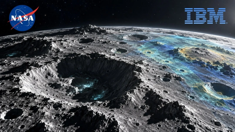
NASA and IBM launch a Lunar Foundation Model, an open-source AI system built to analyze decades of Moon observations. The model combines more than 30 data layers from nine instruments across four NASA missions and is intended to help researchers locate ice, map craters and study volcanic terrain.
IBM and NASA said the system identified important lunar-surface features up to 23% more accurately than widely used methods in benchmark tests. The figure is a maximum reported result rather than a guarantee across every location or task. The release targets three exploration problems:
- Finding potential ice in permanently shadowed regions.
- Mapping craters for safer landing-site analysis.
- Identifying volcanic features across large observation archives.
NASA and IBM Launch Lunar Foundation Model With Mission Data
The publicly available system was trained on observations collected by four NASA missions, including the Lunar Reconnaissance Orbiter. Instead of relying on a single image type, the training set brings together more than 30 layers produced by nine scientific instruments.
Each instrument records a different view of the lunar environment, such as surface appearance, temperature, topography or composition. A model trained across multiple layers can learn relationships that may be difficult to see when scientists inspect one map at a time.
The Lunar Foundation Model joins Prithvi, IBM and NASA's family of open foundation models for geospatial, weather and other scientific applications. The central idea is to pretrain one general representation on a large observation archive, then adapt it to narrower research tasks.
That approach differs from building an isolated model for each crater catalogue or ice-detection project. Researchers can begin with features learned from the broader lunar dataset, reducing the amount of task-specific labeled data and computation needed to test a new application.
Lunar Ice and Crater Maps Support Artemis Planning
Permanently shadowed regions near the lunar poles are a major target because extremely low temperatures can preserve water ice. Confirming its location and accessibility could support drinking water, oxygen production and, after processing, propellant for surface operations or deeper-space missions.
Those regions are also difficult to study. Conventional optical images reveal little where direct sunlight never reaches the surface, so researchers combine measurements from several instruments and missions to infer where ice may exist. AI can prioritize promising areas, but spacecraft observations and direct sampling remain necessary for confirmation.
Crater mapping serves a different operational need. Landing planners must understand slopes, obstacles, illumination and nearby hazards before selecting a site. Faster identification across large datasets can narrow the search, while human teams evaluate engineering requirements that a surface-feature model does not capture by itself.
NASA currently targets 2028 for returning astronauts to the Moon through Artemis. The program is intended to test technologies for a sustained lunar presence and later Mars missions, making high-quality maps useful for both near-term landings and longer-term resource planning.
Related Coverage
The 23% Lunar Mapping Gain Needs Independent Testing
NASA and IBM said the model improved identification of key lunar features by as much as 23% compared with widely used approaches. The announcement did not establish that every task reached that gain, so performance should be evaluated separately for ice indicators, craters and volcanic structures.
Scientific models can perform well on held-out benchmark data and still struggle when observations come from a different instrument, resolution, lighting condition or region. The Moon's polar terrain is especially challenging because shadows, low viewing angles and limited direct measurements can produce ambiguous signals.
False positives also carry different costs across applications. Mistaking a geological feature for an ice indicator could waste scarce mission-planning resources, while missing a small crater could affect a landing-risk assessment. Useful deployment therefore requires calibrated confidence estimates and review by lunar scientists.
The open-source release creates an opportunity to test those limits. Independent teams can evaluate the model on their own labelled regions, compare it with specialist systems and inspect where its outputs disagree with established lunar maps.
Reproducible results will matter more than a single headline benchmark. Model weights, preprocessing code, task-specific evaluation data and clear documentation can show whether the reported improvement transfers to research groups outside IBM and NASA.
Open Lunar AI Could Broaden Planetary Science Workflows
Decades of planetary observations have created archives too large for manual inspection alone. A reusable model can help researchers search those records for patterns, generate candidate maps and compare features across regions before committing expert time to detailed analysis.
The system is not a replacement for physical measurement. It produces interpretations from existing data, meaning its conclusions remain constrained by sensor coverage, resolution and the assumptions embedded in its training set. New orbital observations and surface missions are still needed to resolve uncertain locations.
Its broader value may come from adaptation. Researchers could test whether the learned representation supports tasks beyond the initial demonstrations, including geological segmentation, change detection, terrain classification or prioritizing areas for future instruments, provided each use receives its own scientific validation.
NASA and IBM have already used the Prithvi family for Earth and weather data. Extending the approach to the Moon suggests foundation models are becoming a shared layer for scientific archives, where the same pretraining strategy can support multiple downstream investigations rather than one conversational product.
The next evidence will come from public evaluation: which research groups adopt the Lunar Foundation Model, how it performs outside the partners' benchmarks and whether its candidate maps influence actual mission studies. If those tests hold, the release could turn scattered lunar measurements into a more accessible tool for Artemis-era planning.







0 Comments:
Leave a Reply